This page contains GIS mapping resources used for map making and data analysis.
Census TIGER Line GIS Data
ESRI TIGER Line Files - Census GIS data for ARCexplorer
Census 2000 Tiger Line Data (URL)
Census Data Recipe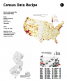 BikeMap.com's Steve Spindler and John Boyle prepared and distributed this document in 2003 that goes over how to make GIS maps with Census data.
Census Data Recipe (PDF, 1.12MB)
ESRI Conservation Program This website describes an ESRI grant program to obtain ArcGIS at a reduced rate.
ESRI Conservation Program (URL)
Free Clone of ArcView - ChristineGIS.com
This website is a free clone of ArcView, that does everything but edit.
Free Clone of ArcView - ChristineGIS.com (URL)
Free GIS Data ViewerAll three of the products described on this site are freely available, easy to use, geographic data viewers whose purpose is to allow organizations to provide access to their GIS to a wide audience of non-expert users.
Free GIS Data Viewer (URL)
 Bicycle Coalition of Greater Philadelphia's John Boyle has compiled and provided a collection of links to GIS related sites that offer on-road bicycle facility or paved path data as well as links to Census Tiger Data. There are links to other free GIS map viewers and on-line bike route mapping applications too.
GIS Bicycle Facility Data - Collection of Links (URL)
GIS Maps for Analysis, Reports, and Presentations
GIS Maps for Analysis, Reports, and Presentations (DOC, 25 KB)
GIS Program - Manifold
 This website is for a GIS program called Manifold which will import and export multiple GIS formats.
GIS Program - Manifold (URL)
There are an increasing number of web-based mapping sites with a growing variety of environmental, social and base maps. This resource is from from page 3 of those ESRI Conservation Program Resources: ECP Grant Guidelines.
How to Make Maps for Free (DOC, 29 KB)
Sample GIS Map (Portland, OR)
 This map from Roger Geller comparing Census bicycle mode share data and bikeways in Portland, Oregon.
Sample GIS Map (PDF, 199 KB)
The State of Our Bridges: Online Tool (Transportation for America)
 69,223 bridges – representing more than 11 percent of all U.S. highway bridges – are classified as "structurally deficient," requiring significant maintenance, rehabilitation or replacement. Transportation for America launched this helpful online tool in 2011 to show citizens the locations of these bridges and assist in determining if a particular state has a lot of deficient bridges or if the state's government does a good job taking care of them.
The State of Our Bridges: Online Tool (URL)
